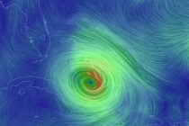
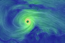
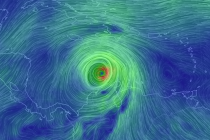
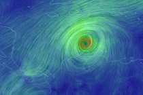
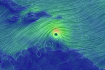
Mar 20: Updated Storm Impact Map
Here is my latest and final storm impact map. This will be the last map I issue as we are now in live-casting mode: Dark blue area: This is my expected jackpot zone once rain changes over to snow. Roads
Overnight models took the storm east however today’s models have taken steps back west to how things sort of looked yesterday. Maybe a half step back. We’re getting to the point now where it’s time to live-cast. Precipitation has been training
Friday night (Mar 18) temperatures should drop into the 30s for most of the state. NNJ elevations could drop into the 20s. Winds should be light out of the N/NW. Saturday (Mar 19) high temperatures should reach the mid-40s statewide.
Model guidance continues to converge on a snow storm solution for the east coast this Sunday-Monday. Expected accumulation amounts are a little tricky to pin down at this exact moment but tomorrow evening I’ll have a very detailed storm impact
The most noticeable trend on today’s models was the eastward shift of the storm’s track. This is now being modeled as more of an offshore/coastal system rather than an inland runner/coastal hugger. That means that the low pressure system would
The first day of spring (this Sunday) could be a wet and windy day. Model guidance has been pretty persistent on a low pressure system tracking through the Mid-Atlantic US this Saturday-Sunday. This system should be all rain for most
This week looks unsettled. We should still squeeze in some sunshine however as mild temperatures continue. Let’s break it down. Monday (Mar 14) high temperatures should range from lower-40s for NNJ elevations to mid-50s for SNJ and the coast. Skies
Light rain is possible overnight but most should fall and clear by 8AM tomorrow, if not earlier. The weekend then starts dry and beautiful but slowly fades towards mild and possibly rainy by the end. Let’s break it down. Friday (Mar 11)
Stomach bugs and doctor appointments are at records highs today and tomorrow as golf clubs, cross-trainers and grills are cleaned. We’ve endured an overall mild winter with only a few transient periods of wintry conditions but I speak for many
High pressure will set up between the SE US coast and Bermuda for the next few weeks. This will drive a pattern of southerly flow through our region—keeping temperatures mild as far as I can confidently see. Let’s break down