Back to homepage

Feature POST on Homepage

Clear and Summery (July 13-14)

Clear and Summery (July 13-14)

🕔20:47, 12.Jul 2019

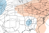
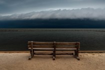
Discussion: The storm front pushed off the SENJ coast early this morning. Unfortunately there was not much relief from the heat and humidity. This time a year that is common for cold fronts. I felt about .06% relief for a

Read Full Article
Jul 11: Thunderstorms Arriving

Jul 11: Thunderstorms Arriving

🕔13:52, 11.Jul 2019

Discussion: Thunderstorms are arriving from SW to NE along and just NW of the I-95 corridor. Initial activity moving into NWNJ is weak sauce but some stronger storms are moving out of the Baltimore/Wilmington area towards Philadelphia and Trenton. Most

Read Full Article
July 10: What Barry Means for NJ

July 10: What Barry Means for NJ

🕔16:20, 10.Jul 2019

Discussion: If you follow weather beyond the Garden State of New Jersey you know that a tropical system is forming in the northern Gulf of Mexico. Primary impacts (high winds, flooding rain and storm surge/tide) from this tropical development (soon

Read Full Article
Nice Start but Humidity to Return (July 8-12)

Nice Start but Humidity to Return (July 8-12)

🕔17:12, 7.Jul 2019

Discussion: Onshore flow, from the developing high to our N/NW, has provided some relief today. That coastal I was watching should pass just to the S of NJ tonight through tomorrow morning. For that reason a few showers and thunderstorms

Read Full Article
July 2019 Discussion with WeatherTrends360

July 2019 Discussion with WeatherTrends360

🕔11:49, 5.Jul 2019

It’s time to harness WeatherTrends360 technology and look at how the rest of July 2019 should play out. WeatherTrends360 algorithms are documented with an 84% verification rate and are based on oceanic water cycles, time table series and very complex

Read Full Article
Florida in New Jersey (July 2-7)

Florida in New Jersey (July 2-7)

🕔12:29, 2.Jul 2019

Discussion: The pattern seems pretty locked this week. If you are familiar with Florida weather then you should have a good idea what to expect. Basically every day will reach summery-warm temperatures (at least 80s everywhere 90s away from the

Read Full Article
Warm and Unsettled (June 28-30)

Warm and Unsettled (June 28-30)

🕔23:54, 27.Jun 2019

Discussion: Upper-level ridging will temporarily give way to a shortwave/ULL between Sunday-Tuesday. That will eventually cool us off a little at the surface. But from now through Sunday morning the heat and humidity should remain. The dynamics Saturday, especially Saturday

Read Full Article
And the Livin’s Easy (June 24-28)

And the Livin’s Easy (June 24-28)

🕔12:01, 24.Jun 2019

Discussion: It’s summertime to further explain the article title. Those of you who never start no static will get it. The week starts with a decaying trough to our NW. The bottom-rounding energy will power a frontal passage of rain

Read Full Article
Marvelous Conditions (June 21-23)

Marvelous Conditions (June 21-23)

🕔21:38, 20.Jun 2019

Discussion: Give it until early-afternoon Friday for rain to clear out. If all goes well it might clear by late-morning. The rain, maybe a few boomers, will be from energy departing with the developed surface low to our NE. After

Read Full Article
Unsettled and Stormy (June 17-21)

Unsettled and Stormy (June 17-21)

🕔21:23, 16.Jun 2019

Discussion: The upper-level jet looks fairly flat and zonal through the N Mid-Atlantic and NorthEast US. Upper-level geopotential height anomalies appear neutral to slightly-below average. Basically a frontal boundary is going to drape and stall through the Mid-Atlantic US this

Read Full Article