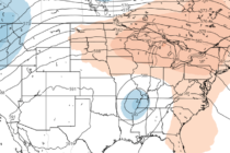
July 31: Thunderstorms are Building
Discussion: The Bermuda high is currently eroding and slipping to the E. Another area of high pressure is currently over the Great Lakes and will track across the NE US towards the Gulf of Maine (passing by to our N