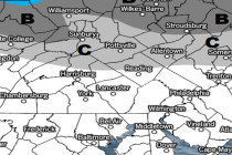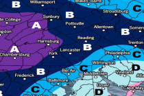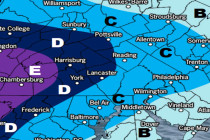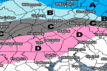
Unsettled Conditions Expected (March 1-3)
Three separate systems should move through the region between late tonight and Monday. The first two are weak. The first could time poorly with Friday AM rush hour. The third may be something to watch. Let’s break down each one: