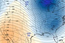
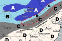
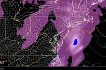
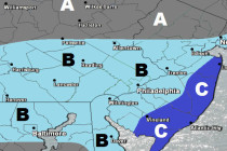
Back to homepage

Latest NJ Weather Alerts

Gorgeous Weekend Expected! (July 10-12)

Gorgeous Weekend Expected! (July 10-12)

🕔11:02, 10.Jul 2015

It doesn’t get much better than this for a summer weekend! Just one caveat to mention but otherwise, a gorgeous weekend is expected. Let’s break it down: Friday should reach the low-to-mid 80s for high temperatures. Skies should feature plenty

Read Full Article
July 9: Severe Weather Update

July 9: Severe Weather Update

🕔12:19, 9.Jul 2015

Storm energy is already building just south of the Great Lakes and is plotting a course for New Jersey. This update is primarily focused on timing. The possible severity of thunderstorms has not changed. EPA and WNJ are still at

Read Full Article
July 8: Severe Weather Possible Tomorrow!

July 8: Severe Weather Possible Tomorrow!

🕔22:08, 8.Jul 2015

A low pressure disturbance will track from the southern Great Lakes directly over New York City tomorrow. This synoptic system will plunge into an air mass favorable for thunderstorms (some humidity and marginal instability). This will also create a conflict in

Read Full Article
July 8: Thunderstorm Update

July 8: Thunderstorm Update

🕔16:09, 8.Jul 2015

A cold front is moving through PA towards NJ. Ahead of it lies destabilized and unsettled air mass currently responsible for widely scattered showers and thunderstorms. There’s hardly any wind shear so these are mostly instability-driven with tropical surface fuel

Read Full Article
Stormy Week Expected (July 6-10)

Stormy Week Expected (July 6-10)

🕔12:27, 6.Jul 2015

The Bermuda high remains stubbornly positioned for warmer southerly flow all week. This, in addition to several low pressure disturbances passing through from our west should keep it stormy and wet despite a few sunny clearings. Let’s break it down:

Read Full Article
4th of July Fireworks Forecast

4th of July Fireworks Forecast

🕔10:59, 4.Jul 2015

Rain showers currently span from Baltimore, through E. PA and into NWNJ. They will continue to push east in a scattered nature (not widespread) until ultimately fizzling by early evening. Satellite imagery indicates a wall of much drier air moving

Read Full Article
Mostly Decent Weekend Expected (July 2-5)

Mostly Decent Weekend Expected (July 2-5)

🕔16:53, 1.Jul 2015

Most of New Jersey looks pretty good through July 4th weekend except for a few road bumps. There exists just a small chance of clouds and rain on Thursday and Saturday associated with a frontal boundary that will be stationed just to

Read Full Article
June 30: Thunderstorms Approaching!

June 30: Thunderstorms Approaching!

🕔13:55, 30.Jun 2015

A line of thunderstorms is currently forming in E. PA and will slowly push east—as showers and thunderstorms remain fueled by southerly winds and moisture in the warm sector. Given this traditional setup, western parts of NJ have a much

Read Full Article
NJ Long Range Outlook – What to Expect for July!

NJ Long Range Outlook – What to Expect for July!

🕔19:16, 29.Jun 2015

It’s time to use the crystal ball and harness the WeatherTrends360 proprietary weather algorithms for a look at July 2015. But first lets break New Jersey into proper climatological regions. We have the upper elevations of NNJ/NWNJ, the interior coastal plain (SWNJ through CNJ

Read Full Article
Week Starts Nice. Ends Wet (June 29-July 3)

Week Starts Nice. Ends Wet (June 29-July 3)

🕔09:53, 29.Jun 2015

The first part of the week should be nice with weak high pressure in control. Then at some point on Wednesday, a series of weak low pressure disturbances should begin taking fire at New Jersey from the west. This would keep

Read Full Article