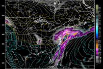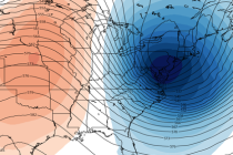
Seasonably Average Week Expected (Dec 1-5)
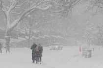
With the exception of Tuesday, we’re looking at a seasonably average week for December. Some would even call it mild. Higher elevations of NW New Jersey could see wintry precipitation Tuesday night into Wednesday morning. It looks like rain for all lower elevations.