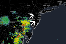
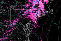
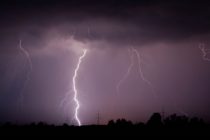
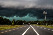
Winter Storm a Go
Discussion: Models have continued to shift E with their surface output (how much snow falls and where). However the upper-levels indicate that the shift is not exactly as far E as you would think. Some models, like the GFS and
Discussion: The potential for a major NJ snowstorm this weekend has not gone away. The general period of interest is Friday night through much, if not all, of Saturday. Let’s discuss what has happened in the last 24-hours. Last night’s
Discussion: The focus this week will be on the potential major winter storm this Saturday. Model guidance continues to trend towards a KABOOM storm system riding up the coast. But we’re not there yet. There’s still some time to continue
Discussion: Flurries, maybe even some snow showers are possible from now through tomorrow morning as low temperatures eventually range from teens to 20s from N to S. Anything from a trace to a coating is possible since anything that falls
Discussion: A disappointing turnout this morning if you love snow. The Arctic front verified slower than all computer model guidance but is still definitely coming through. Temperatures should fall for the rest of today and especially after sunset tonight. I
Discussion: A light snow event is approaching New Jersey and should impact the Thursday AM commute. First, we will see a mild day today (Wednesday) with afternoon high temperatures reaching well into the 40s statewide. A weak wave of energy
Discussion: Two snow events are on the table this week, one for Thursday and another for Saturday. Let’s break them down. Thursday looks like a generally light event. After a milder day in the 40s (Wednesday), rain should begin approaching
Discussion: Just wanted to thank you all for the support and kind words! The last few articles leading into the storm were actually picked up and aggregated by Google News. I look forward to more responsible discussion about weather safety,
Discussion: Earlier this week, a short wave dropped into the N US and dove to Texas to form a closed-off upper-level low (ULL). This ULL drifted E a bit, through the SE US, before interacting with another upper wave, that
Discussion: This upcoming Sunday PM-Monday AM event is not a pure snowstorm. It will contain some wintry aspects to it (upfront snow…possibly ending as snow for some) but the meat and potatoes of it are a strong synoptic-scale rain and