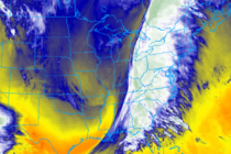
Unsettled Conditions (Jan 1-3)
Discussion: Precip should slowly clear from W to E this evening. It’s possible some snow/sleet mixes in but nothing crazy. The S side of passing high pressure should then improve conditions overnight into Friday morning. Clouds and rain should then