Heat Wave Begins
Discussion: When the sun sets like that, you know it will be hot the next day. And that’s what I expect some of the sunsets to look like this week. Between now and this weekend, the upper jet is going




Discussion: When the sun sets like that, you know it will be hot the next day. And that’s what I expect some of the sunsets to look like this week. Between now and this weekend, the upper jet is going

Discussion: The upper-level zonal flow pattern this weekend is going to evolve into what we call a summer death ridge for next week. This means the upper jet will buckle northwards well to the N of NJ and leave NJ
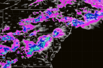
Discussion: We’ll start this week off in article mode since there is potentially damaging weather on the way. First, we have a series of weak low pressure tracking to our immediate NW (likely across NWPA from the Ohio River Valley

Discussion: The upper levels continue to indicate a zonal flow across the US this weekend into next week. This translates to more of a W/NW to W/SW wind direction at the surface which you’ll see in the days broken down
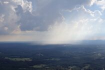
Discussion: The upper levels suggest a zonal flow this week with height anomalies leaning slightly negative for NJ. At the surface this should produce another beautiful day (like Monday – today) for Tuesday but then unsettled humidity Wed-Fri. Wednesday seems

Discussion: The current tropical air mass (beneath the E US ridge) will give us one more hot and humid day today (Friday). We’ll mostly be in a warm sector flow ahead of a cold front which will make the heat

Discussion: This article will begin with a rant. The last thunderstorm outbreak (Saturday-Sunday) really bothered me, specifically the disconnect between the professional forecasting base and public consumers of weather forecasting. I absolutely hate that Severe Thunderstorms (for wind) are determined

Discussion: The jet stream will remain N of NJ (ridging) for the foreseeable future, except for this Saturday into Sunday when a positive and progressive trough will quickly move through. This is not enough for a washout but more of

Discussion: Upper-level analysis confirms that we are now under the influence of the Omega block, particularly the N flow moving down and around the W side of the leading trough. This is going to produce northerly winds in general between

LOCAL FORECAST | INTERACTIVE RADAR | LATEST NJ WEATHER ALERTS | WEDDING FORECAST| PRIVACY POLICY
© Copyright 2026 Weather NJ LLC. All Rights Reserved.
Some information that can be found on our website is provided by a private weather station and is not an officially recognized station for weather reporting. Though we always strive to achieve accurate reporting for our own use, it is important that you do NOT depend on the data provided here for any purpose.


