Milder Conditions Expected (Dec 18-22)
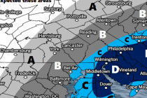
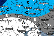
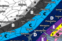
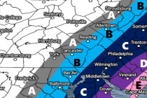
Discussion: Real quick, scattered light precipitation could fall overnight tonight. Only NJ areas N of I-78 would be cold enough for wintry precipitation. Very light amounts are expected but could still slick-up the early AM rush hour commute tomorrow. Moving