A Taste of Winter (Nov 8-10)
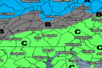
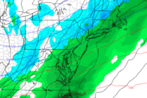
Discussion: Rainfall is pushing through NJ as expected. Rain to start and finish for most areas with just a chance of NWNJ elevations ending with wintry precipitation. Elevations greater than 1200 feet should expect anything from just rain ending as