Conditions to Improve (Mar 31-April 2)
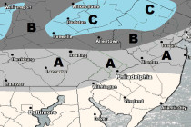
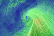
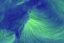
Conditions should improve for the weekend once the rain moves out. Let’s break it down… Disco: Low pressure is currently tracking over Ohio which is stacked and closed-off from the surface up through 500mb. This area of low pressure will