Labor Day Weekend (Aug 30-Sept 2)
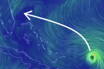
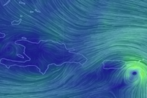
Discussion: Lots of high pressure will be around this weekend and that’s what will likely turn Hurricane Dorian into the E Florida coast. For New Jersey it means a stellar Labor Day Weekend forecast with only some nuisance stuff around