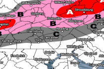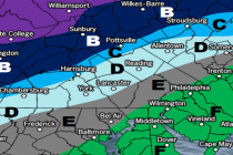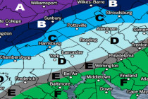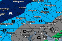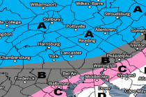
Cold and Dry (Jan 25-27)
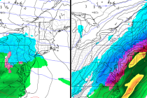
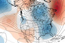
Discussion: Winds should remain breezy overnight but subside by morning. 500mb height anomalies look cold and troughy for the E US from tomorrow into at least the first week of February. If you look at the 250mb jet it’s raging across