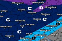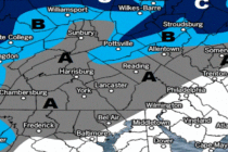
High Winds Predicted Thursday
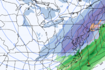
Discussion: Nothing has really changed for the next few days. We’ll be under the colder influence of the NW flow through Wednesday, generated by the departing trough/approaching ridge (NW winds for most levels under 250mb). Today’s the coldest day with