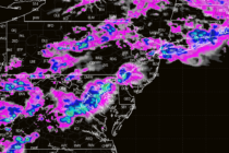
Another Damaging Storm Period Detected
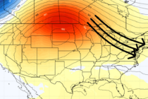
Discussion: The weak low that was over the Mid-Atlantic US and contributed heavily to yesterday’s flash flooding/heavy consistent rainfall, is now offshore just S of Cape Cod. This is now producing northerly flow behind it (to the W of it