Dec 12: Snow Event(s) Detected
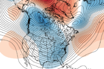
Discussion: This discussion is for two separate disturbances expected to occur this coming week. The first is on Monday (Dec 14) and the second Wednesday into Thursday (Dec 16-17). For the first event on Monday, we have a trough anchored